

Ever since I first climbed on a carbon whip, I’ve loved going uphill. Maybe it was decades riding on steel, or my experience bike camping on loaded touring bikes, but powering skinny tires up a steep grade makes me break out in polka dots. Over the years, I’ve become acquainted with some of the toughest, most beautiful, and interesting routes California has to offer. Here, I’ve collected five of the best from the Bay Area up to Sonoma County.

Old La Honda
Old La Honda isn’t the toughest climb you’ll do. Far from it. But what you’re battling on Old La Honda is not the grade or the height, it’s the thousands of riders who’ve done it before—and yourself. With more than 16,000 efforts, this is one of the most ridden segments in the world on Strava. This is how you measure your progress.
Old La Honda Road climbs up out of Palo Alto, to the ridge west of Silicon Valley, dumping you out almost unexpectedly on beautiful Skyline Boulevard, where tracks in the dirt belie the thousands of previous visitors. The road isn’t much to look at. It’s wooded, and while that means nice shade (it’s cool even on a hot day) and pretty trees, there are hardly any vistas to speak of. It gets darker as you go higher, as patches of redwoods become a forest of them. The road surface is smooth, though it narrows to one lane. It’s just three miles, with 1,300 feet of elevation, and you almost don’t even know when it begins. (Hint: it’s the bridge.)
It’s not brutal, with an even, consistent grade. It’s not long—the Strava KOM is 14:38. What it is is the benchmark. If you’re coming off the off-season, or getting back in shape, or if you think you’re peaking and want to see how you stack up against other riders, this is the climb you do it on. You won’t be alone (ever), and on weekends it’s not uncommon to see hordes of cyclists egging each other on, or to get passed by pace lines of young riders with tech jobs.
Bonus: If you want more than Old La Honda alone, descend the other side of the ridge, toward the ocean, and climb back up via Tunitas Creek Road—it’s long, challenging, and beautiful.

King’s Ridge
Immortalized in both the Tour of California and the Levi’s Granfondo, King’s Ridge is more than just a single climb. It’s a series of challenging climbs, interspersed with ridgeline rollers and several big descents. It’s also one of the most consistently scenic rides in Sonoma County, with views of seemingly endless mountains on one side, and the bluffs of the coast on the other.
Departing from the Russian River Valley, the ride begins with a nice, six-mile, barely-more-than-flat warm-up through the redwoods to the town of Cazadero. The climb starts in earnest as you leave town.
From here, it’s a steep seven miles, taking you further and further into seclusion that won’t abate until, hours later, you’re kicked out onto coastal Highway 1. You climb up the face of the ridge and negotiate several huge switchbacks that allow you to look down on anyone lagging behind you. Finally, you crest the ridge, and the views start to come at you from all sides.
Now you’ll follow the ridge for eight miles. Rollers may be an understatement—the downs are big enough to deceive you into thinking you’re done, and the ups are longer and steeper than they appear.
Overall, the road surface is not great, which isn’t a huge problem on the ascent. But the primary downhill, which I’ll include because it merely sets you up for more climbing, is steep and rough, with a surprisingly sharp turn just before the bottom.
Then it’s up again, regaining all that elevation you lost. If you’re still paying attention (and not cursing your decision to take this ride) you’ll see the climb gradually reduce to a long stretch of small ups and downs, unremarkable except for the occasional view of the ocean off to your right. Finally, you’ll plummet down a thousand feet to the coast.
Mount Diablo
Mt. Diablo haunts the Bay Area, tall and lonely and imposing, just visible over the Oakland Hills from the right vantage point in San Francisco. There are two entry points, North Gate and South Gate—though there are trails as well, if you’re equipped with a ‘cross or adventure bike. South Gate is longer, with a little more climbing, but with the tougher climb comes better views.
Each would be a significant climb on its own, up what could be described as Diablo’s foothills. These make Diablo less isolated than it first appears, the upshot of which is that there are a few blessed stretches of flat or even downhill as you ascend. But once North Gate and South Gate roads merge for a 4.5-mile push to the summit, there’s no real respite.
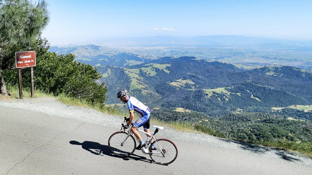
Charred, dead trees taunt you, as if saying, “this could be your fate.” Elevation signs denote each 1,000 vertical feet. In the winter, you’ll warm up on the climb, but prepare to bundle up for the (otherwise very fun) descent. In the summer, it’s devilishly hot, dry, and exposed. Thank heaven for the water spigots strategically placed on the way up, though note that some have been turned off due to drought.
As you reach the peak, you’ll see hikers and other tourists, and a ranger station/museum. Your elevation here: 3,849, having ascended 11 miles and 3,400 feet from the base. Pro tip: Leave a little something in the tank for the last ¼ mile.
Mount Tam
There are many ways up Mount Tamalpias. You can start in Mill Valley and climb to four corners, then follow the aptly named Panoramic Highway, or you can come via Fairfax and Alpine Dam. But my personal favorite starts in Stinson Beach. Take a nice easy spin along Bolinas Bay on the famed Highway 1 before making a right on Bolinas-Fairfax Road.
The seven-kilometer climb is marked nicely, each kilometer ticked by paint on the pavement. At first, you’ll catch views of Bolinas Bay, and if you’re lucky, a nice sea breeze. The kilometers will roll by in a pleasing fashion, not the most difficult, but always a challenge. As with Old La Honda, as you go higher the shade of redwoods will obscure the view. This is the top of the sustained climbing section. But wait—you’re not done.
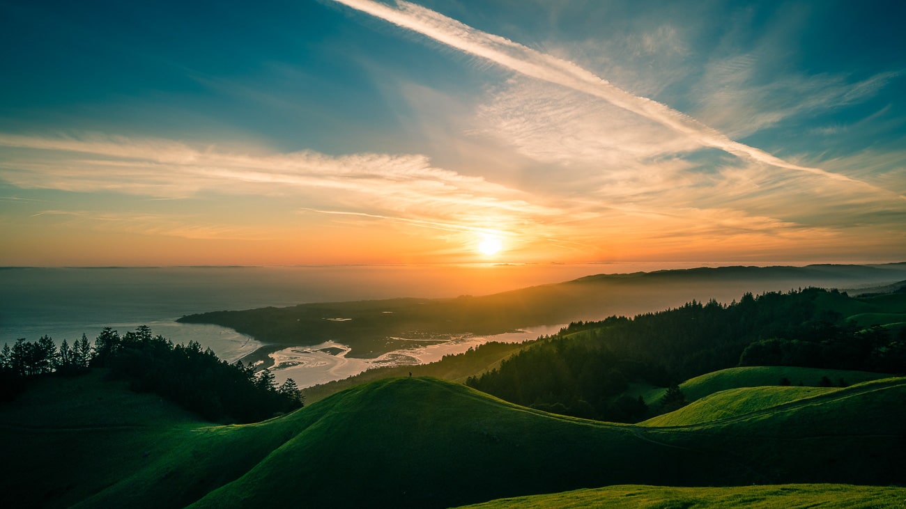
Next you’ll come to the Seven Sisters, a nice set of rollers with a stunning view of the Pacific Ocean, which lies off to the right over round, grassy bluffs. The sisters would be a breeze, if you hadn’t just tackled Bo-Fax. Up one, down the next, and repeat until you reach the parking lot. Again you’ll feel like you’re done. You’re not. To reach the peak, you have to go up… and down… and up. See, Tam has two peaks, and though they feel so close you still have to climb 500 feet, descend 250, and then climb another hundred or so. Once you’re finally there, take a breather and observe San Francisco from on high—if the city’s trademark fog will allow it. But don’t rest too easy. You’ve got to get back up and over West Peak before you can spin down the twisty descent through redwoods back to Highway 1.

Geysers
Around the backside of Geysers Peak, in Sonoma County, the deserted Geysers Road follows a hidden canyon up through geothermal heaven. Right as you begin, exiting the town of Cloverdale heading east, a sign greets you: “This road made safer for you by Levi’s Granfondo and the county of Sonoma.”
I wouldn’t go so far as to call it safe. As you ascend, every now and then, there’s a hundred meter stretch of gravel, as if the hill is reminding you just how rugged and out of the way it is. This is not a great disruption on the climb—a welcome distraction, really—but on the brake-burning descent, whipping around a corner to find you’re bearing down on a stretch of loose gravel is rather harrowing.
But we’re not here for the descents; it’s the climb that distinguishes Geysers Road. Big Sulphur Creek rushes by below, off to the right, at the bottom of a rocky canyon. Alternately narrow and deep, or wide, beside a rangy meadow, the river parallels your progress.
The first 13 miles (yes, 13) are pleasant, with spots of shade and a manageable grade. As you near the top, big, cornered pipes—the instruments of Western GeoPower—scrape the sky like awkward elbows. Here, you’re in the center of the world’s largest geothermal field, and the steam from the earth is funneled to turbines that power much of northern California.
As you near the top, you’ll reach an intersection. The fun is over; now it’s time to work. Two miles of hard, steep, 9% climb stand between you and the top, followed by a false descent and more climbing. As you round the last pass, Alexander Valley and the rest of Sonoma County stretch off to the south, both a reward and confirmation of just how high you’ve come.
Follow Nathan on Strava or come ride with him on a DuVine tour in California.

